Abstract
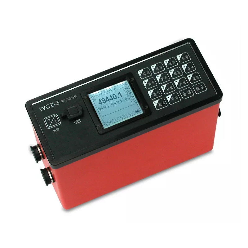
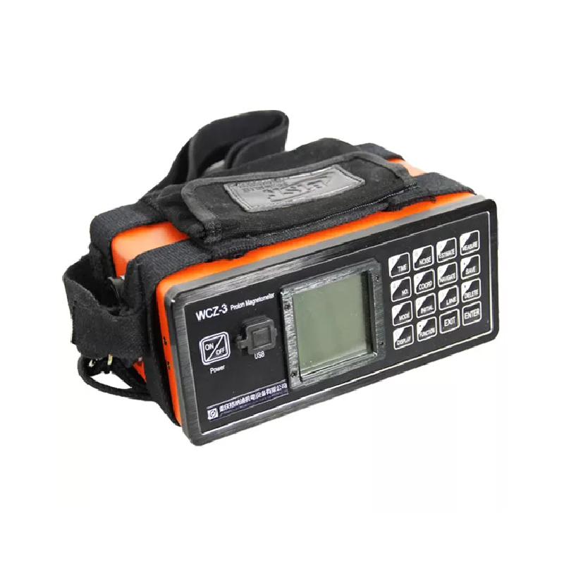
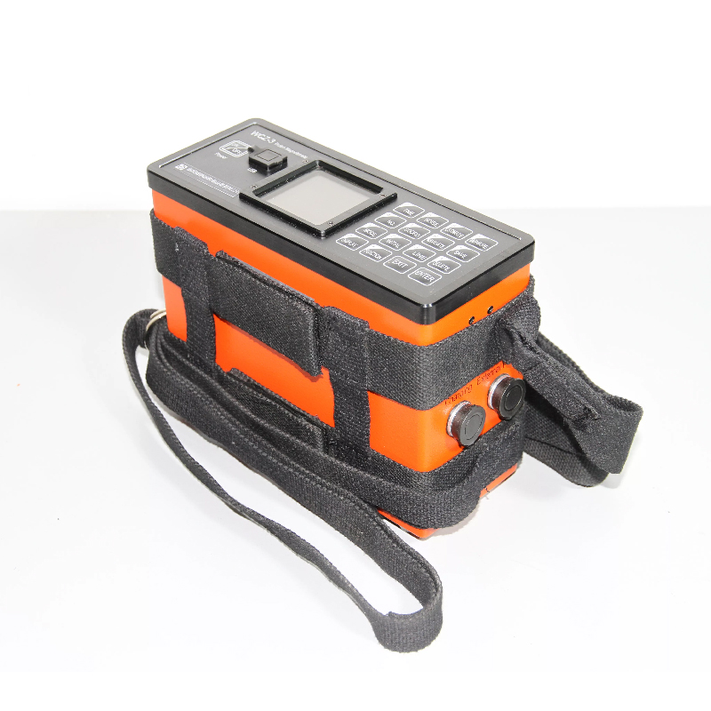
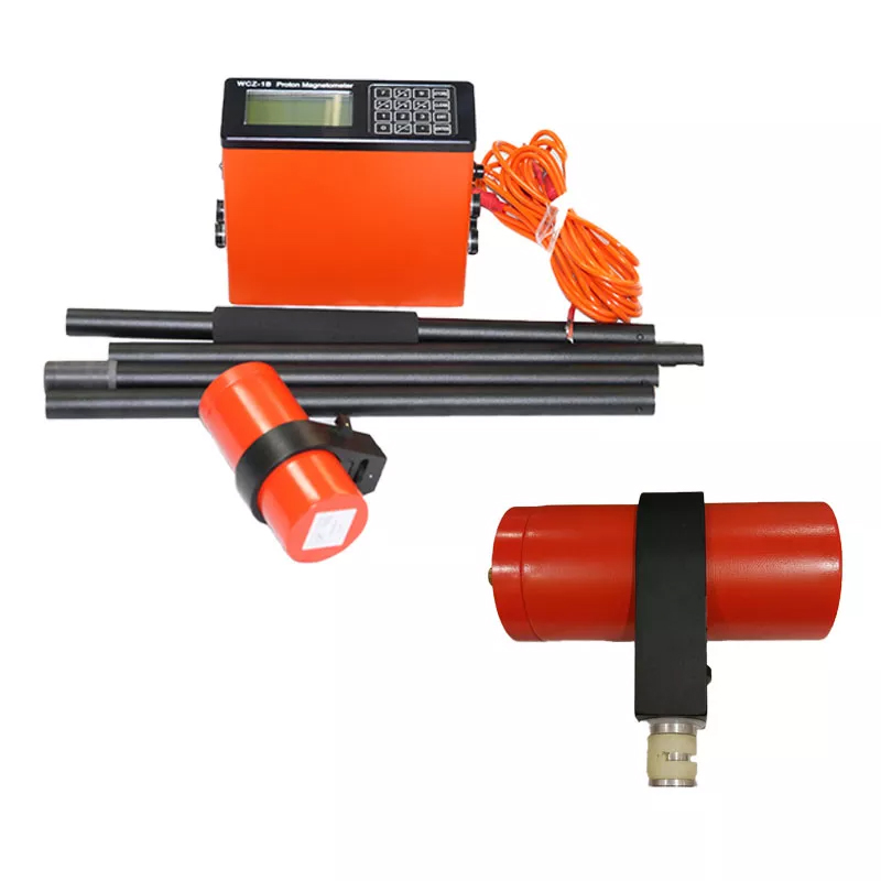
WCZ-3 proton magnetometer is a new generation of fully digital proton magnetometer , which is realized by using dual 32-bit single-chip technology. It is also the fastest and most comprehensive ground proton magnetometer so far. Its measurement speed is greatly improved, its gradient tolerance is greatly enhanced, and its weight is greatly reduced. It has more complete GPS navigation capabilities and is competent for mobile total field measurement, horizontal gradient measurement, vertical gradient measurement and base station measurement, etc.
Applications
● Mineral exploration, iron ore,lead zinc ore,copper ore ,etc
● Cooperate with mineral survey, research on buried depth, attitude and continuity of mineral ore, research on shape and size of mineral ore, estimate the scale of mineral deposit
● Exploration of petroleum, natural gas, research on geological structure and geo-structure in connection with gas/oil
● Reconnaissance survey, detail survey, geologic mapping
● Surface daily change station of geomagnetic survey of aviation and ocean
● Engineering survey,pipeline detection, etc
● Monitor the earthquake precursors, volcano survey, other environmental and isastrous-geological work
● Detection of minor-scale ferromagnetic body, etc
● Fault location
● Archaeology
● Hydrology
Features
● Vertical integrated design
WCZ-3 has built-in GPS antenna, GPS module and lithium battery module, which makes connection easier and work more reliable
● Quick measurement
WCZ-3 only takes 2 seconds from starting measurement to displaying readings
● Supports automatic/manual tuning
WCZ-3 can be fully automatically tuned or manually tuned.
● Excellent gradient tolerance
In a higher gradient environment, the magnetic field estimation value of the measuring point can be obtained through the device's proprietary "estimation" function.
● Support multi-scene measurement
WCZ-3 can perform total geomagnetic field measurement, horizontal gradient measurement, vertical gradient measurement and base station measurement.
● Optional gradient measurement mode
WCZ-3 supports both traditional single-channel dual-probe time-sharing gradient measurement and dual-channel dual-probe simultaneous high-speed gradient measurement.
● Complete GPS navigation function
WCZ-3 supports importing the coordinates of each point on the measuring line in text file format, and can also automatically calculate the position coordinates of each measuring point by presetting the coordinates of the end points of the measuring line.
● More accurate clock synchronization
Relying on the GPS timing function to automatically correct the built-in precise real-time clock of the instrument to ensure accurate synchronization of the clocks of the base station and each mobile measuring station.
Specifications
Channels | Channel(standard configuration, for separate gradient measurement) Channels(optional, for simultaneous gradient measurement) |
Measuring range | 20,000 nT ~ 100,000nT |
Accuracy | ±1nT |
Resolution | 0.1nT |
Gradient permitted | ≤8,000nT/m |
Measuring speed | larger than 2s/reading |
Station measuring interval | 2~60s, optional |
Data stored | large than 2 billion points readings, with power-off protection |
GPS Positioning accuracy | higher than 2.5m CEP |
LCD display | 160×160, with backlight |
Keyboard input | 16 keys |
Port | USB standard serial port |
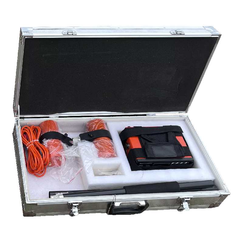
Power source | Rechargeable lithium battery (for 4000 times reading), external power supply optional (12V) |
Console dimension | 206mm × 85mm ×155mm |
Weight | 1.5Kg (including battery) |
Sensor size | φ75mm×155mm |
Sensor weight | 0.8 Kg |
Working temperature | -10 °C~+50 °C |
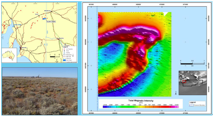
Case study
Olary iron project mineral resouce estimate in South Australia by magnetic method